
Government of Lesotho Kingdom under the supervision of WFP. The World Food Programme (WFP) is the food assistance branch of the United Nations (UN), the organization’s Operation Department of Emergency Preparedness (ODEP) actively supports various emergency relief efforts around the world with GIS analysis. To facilitate this work, it has developed a methodology using GIS to understand the higher vulnerabilities among populations living in areas prone to natural disasters. This analysis considers factors such as environmental degradation, food insecurity, malnutrition, and the historical occurrences of natural hazards Satellite images are analysed to identify poor growing seasons and years of low crop productions.
The analyses help WFP quickly develop intervention strategies when disaster strikes. In addition to data acquired from the host country and the data it collects, WFP obtains regular updates regarding seasonal food insecurity conditions throughout the world from the US Agency for International Development (USAID) Famine Early Warning Systems Network. USAID analyses the data it receives from US agencies, including the National Oceanic and Atmospheric Administration, National Aeronautics and Space Administration, United States Geological Survey, and the United States Department of Agriculture, to produce its reports and forecasts, which it then provides to WFP and other relief agencies.
The Pain: The Situation Prior to Project Implementation
The ministries faced several key challenges in reaching required results, including:
- Lack of a centralized repository for spatial data analysis or integration.
- Absence of collaboration among different ministries for decision support.
- No available analysis for climate change, deforestation, or the status and performance of urban forests
The Proposed Solution:
Integrated Geospatial Platform for Territorial Planning. The platform serves as a comprehensive solution aimed at making harmonized and high-quality Geospatial Information readily accessible. It offers a standardized Platform for Discovery, Searching, and Accessing crucial datasets such as Base maps, Imageries, and Sectorial Datasets for government organizations and seniors.
By serving as a central repository for spatial and non-spatial data across different government ministries and agencies (currently only 4 ministries are engaged in the platform), the platform facilitates efficient data management and accessibility.
The platform provides functionalities for geographic data visualization, providing key insights, spatial analysis, and user interaction. It is based on Esri state of the art technology, and it represents a unified geospatial platform that provides the best means for working with both geographic and statistical data.
The Steps Taken: Our Path Towards the Solution
In an effort to address the challenges at hand, we embarked on a strategic approach, ensuring that our proposed solution was effectively and meticulously implemented:
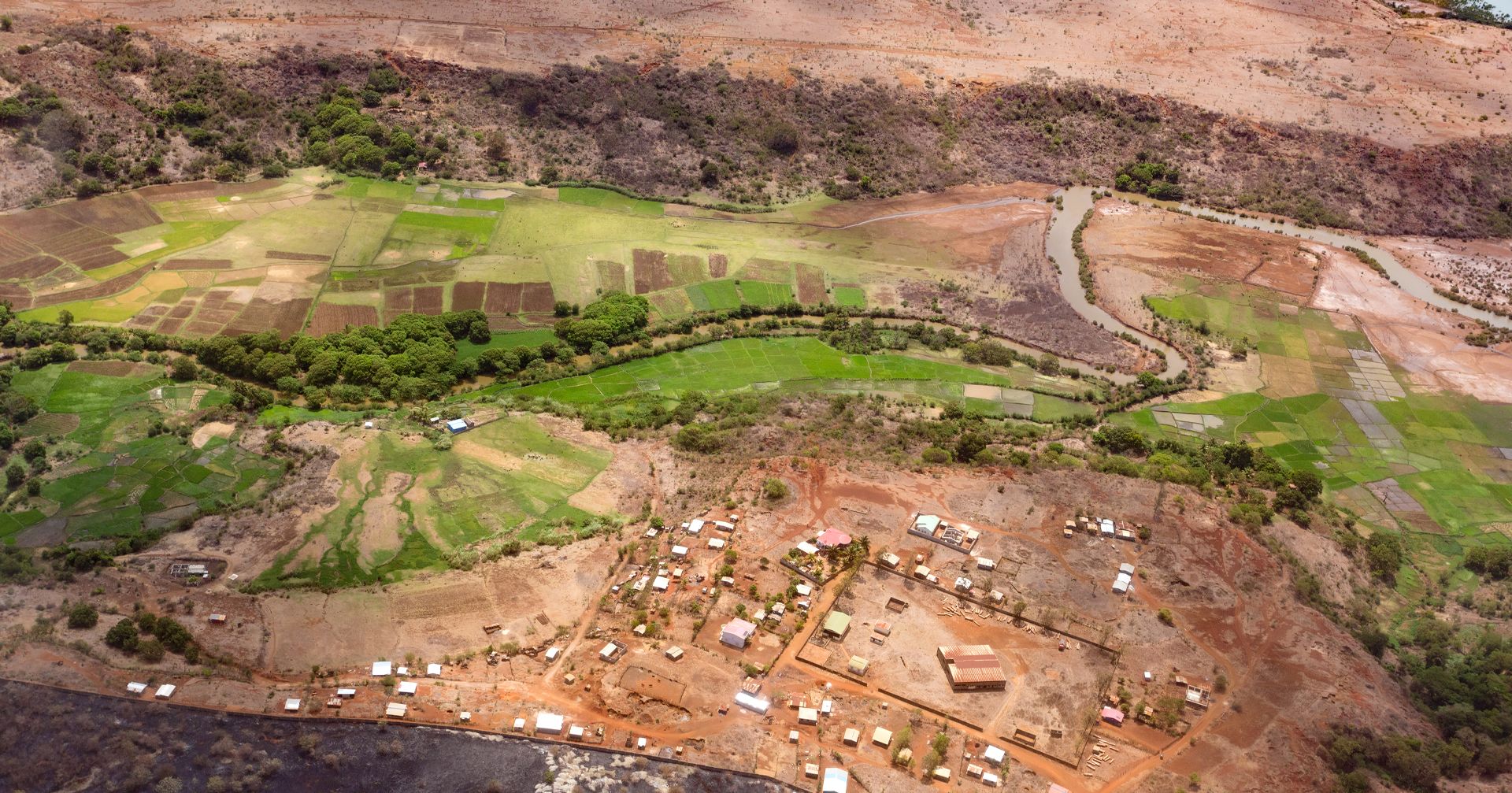
- Monitor forests tree health and growth, schedule trimming and treatment and set policies for environmental development.
- investigation comprehensive knowledge on the status and performance of the urban forest in order to preserve and enhance it.
- observation and monitor on forests the tree's spatial distribution within the Lesotho.
- Determining the change of vegetation cover and its relationship to rains, water resources.
- Adaptation of agricultural land to the climate.
- Locations of soil types and their impact on vegetation (identifying suitable types of crops)
- Determine of soil erosion sites and their impact on vegetation cover.
- Limit the erosion and degradation of agricultural land to reduce the erosion process to achieve sustainability.
- Protecting agricultural land is important to food security.
- Develop Lesotho's livestock economy.
- Increasing the area of agricultural land more than 10%.
Challenges Faced During Implementation
- Resistance During Requirements Gathering: Significant resistance was encountered from end users during the requirements gathering phase. Overcoming this resistance required additional time and effort to address their concerns, build trust, and demonstrate the value of the project.
- Request for Major Changes: After the platform implementation was completed, the client requested a major change in the project deployment. This required substantial modifications to the platform's structure and implementation within a short timeframe. The team faced considerable challenges in adapting to these changes while ensuring minimal disruption to the platform's core functionalities and features.

Situation After Successful Implementation
The implementation of the project brought significant enhancements to our system and addressed the issues we previously faced:
- Facilitating enhanced spatial data analysis and integration.
- Providing KPIs and insights for senior management and decision makers.
- Enhancing collaboration with various stakeholders on a national level.
- Improving geographic information management as a means to enhance decision support.
- Making maximum use of existing data and information systems in order to avoid duplication of efforts.
- Climate change analysis.